Cooper Lake
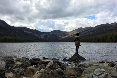
This short and easy hike leads you directly to Cooper Lake, which sits at the headwaters of the Moyie River. The hiking trail passes through a mixed forest of aspen, pine and spruce following the route of a log flume from the 1920s. At the outlet of Cooper Lake, you can camp near the remnants of the sluceway that fed the log flume that delivered logs to Lumberton.
In spring and summer Cooper Lake is popular with anglers. Huckleberry pickers will enjoy this walk in the fall. In the winter, ski touring groups and snowmobilers share Cooper Lake.
WHAT TO EXPECT:
- A wide and leisurely 3.3 km hike to the lake
- An elevation gain of 480 m (1570 ft.)
- Active logging road access (24.6km)
- Expect 40 mins - 1 hour hike to reach the lake.
DIRECTIONS:
- Commencing at the south end of Cranbrook, follow Hwy 3/95 for 10.7 km past the Visitor's Centre.
- Turn right (west) onto the Lumberton Road. Follow this main road as it switchbacks up the hill under the power line.
- At the 9 km road marker, take the left fork onto the Moyie River Road. Set your odometer to Zero.
- At 3.1 km stay right, past the Semlin Creek Road.
- At 12.1 km stay left, past the Ryder Creek junction.
- At 13.9 km stay right, past the road to the powerline.
- At 16.8 km park in the wide spot on the road. The trailhead is often behind overgrown foliage.