Top of the World Provincial Park
Top of the World Provincial Park is a remote wilderness park.
Established Date: April 9, 1973 | Park Size: 8,790 hectares
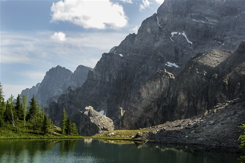
High in the Kootenay Ranges of the Rocky Mountain region of SE British Columbia is one of the alpine gems of our park system, Top of the World Provincial Park. An area of great beauty, the park is part of the Top of the World Plateau, most of which is at an elevation in excess of 2,200 metres. The jagged peaks of the Hughes Range form a backdrop to the west of the park, and the Van Nostrand Range dominated by Mount Morro--at 2,912 metres marks the highest point in the park.
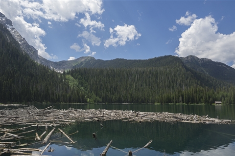
Camping and hiking are popular activities in this backcountry park that has many family-friendly features. An easy, improved and well-maintained trail leads to Fish Lake, where a 16 site lake-side campground is located. There is also a public cabin available accommodating 14-18 people.
The moderate hike to Fish Lake is 6.2 km, and it gains 213 m (700 ft.) elevation. The scenic lakeside is at 1768m (5,800 ft.). The trail to Fish Lake is smooth & serene, you could even bring your mountain bike!
Once you arrive at Fish Lake, you have made it to the basecamp of a multitude of day-hikes and a loop trail around Fish Lake.
DIRECTIONS:
- Via Whiteswan Lake: Turn east off of Highway 93/95, 4.5 kilometres south of Canal Flats.
- At kilometre 21.3 take the fork to the right (Lussier River Junction).
- At kilometre 29.6, turn right and cross Coyote Creek. Continue straight at kilometre 30.7
- Staying on the main road until reaching kilometre 52. The trail begins at this point.